Map of the Journey of the Exodus, 1585, NLI
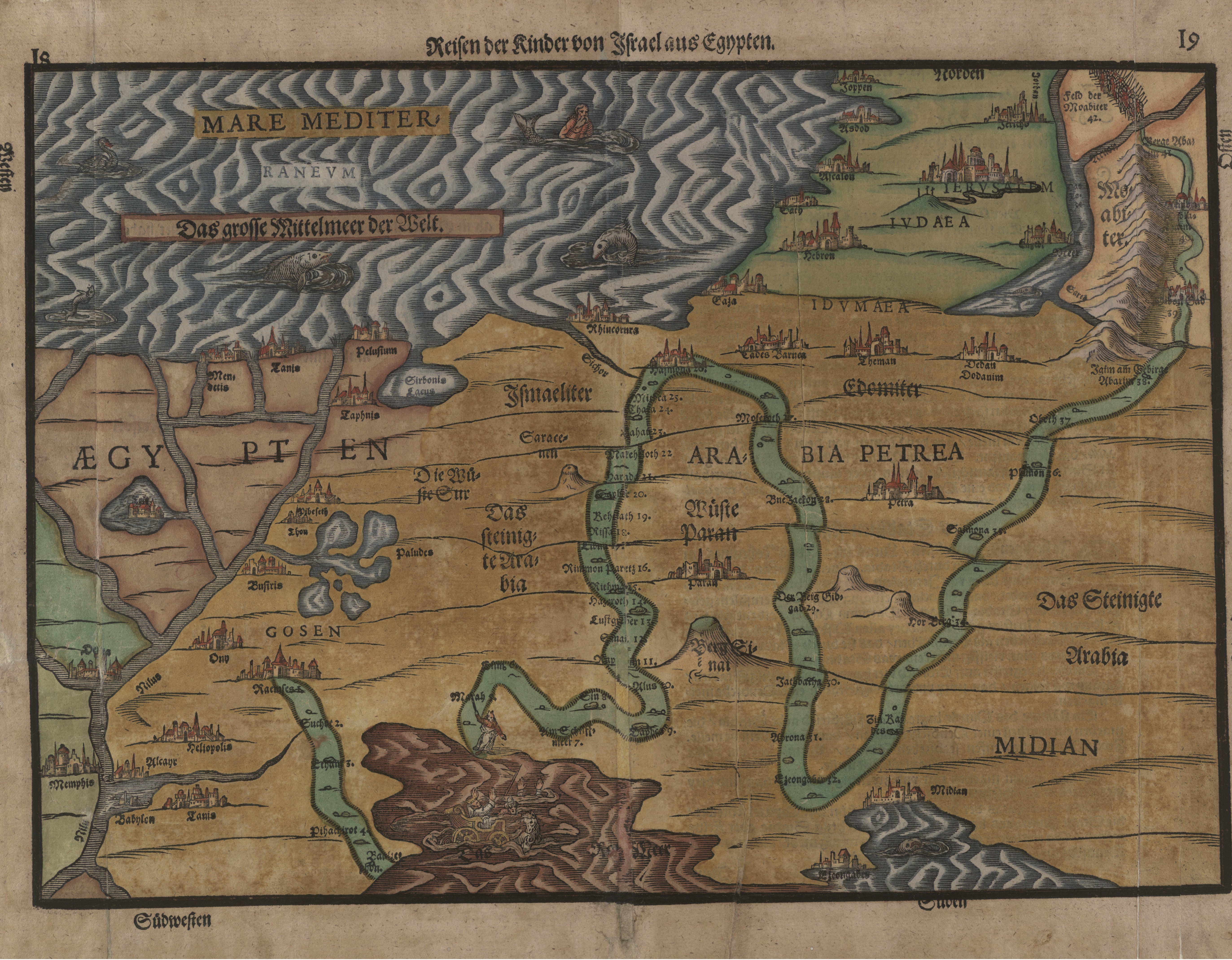
This map describes the journey the Israelites took from Egypt to Israel, including the forty stops they made along the way. It also depicts a number of the events that occurred during the journey. For example, Pharaoh and his chariot can be seen drowning in the Red Sea, aptly coloured red, while the figure of a horned Moses holding out a staff over the Sea appears on the other side.
The map's creator, Heinrich Bunting, lived in Germany during the Renaissance period in the sixteenth century and presented the biblical story from the more accurate scientific perspective of the time.


Inspired to create
your own Haggadah?
Make your own Haggadah and share with other Seder lovers around the world
Have an idea
for a clip?
People like you bring their creativity to Haggadot.com when they share their ideas in a clip
Support Us
with your donation
Help us build moments of meaning and connection through
home-based Jewish rituals.
OUR TOP CONTRIBUTORS

Esther Kustanowitz
4 Haggadahs • 44 Clips
JQ International
1 Haggadah • 40 Clips
MAZON: A Jewish Response to Hunger
5 Haggadahs • 109 Clips
18Doors
1 Haggadah • 13 ClipsJewishBoston
1 Haggadah • 78 Clips
Truah: The Rabbinic Call for Human Rights
1 Haggadah • 36 Clips
American Jewish World Service
1 Haggadah • 44 Clips
JewBelong
3 Haggadahs • 57 ClipsRepair the World
12 Clips
HIAS
5 Haggadahs • 48 Clips
Be'chol Lashon
2 Haggadahs • 27 Clips
PJ Library
1 Haggadah • 17 Clips
Jewish World Watch
3 Haggadahs • 42 Clips
Secular Synagogue
10 Clips
SVIVAH
1 Haggadah • 9 Clips
The Blue Dove Foundation
20 Clips
ReformJudaism.org
24 ClipsJewish Emergent Network
1 Haggadah • 22 ClipsPassover Guide
Hosting your first Passover Seder? Not sure what food to serve? Curious to
know more about the holiday? Explore our Passover 101 Guide for answers
to all of your questions.